Fate Sanders Barrens Class II Natural-Scientific State Natural Area

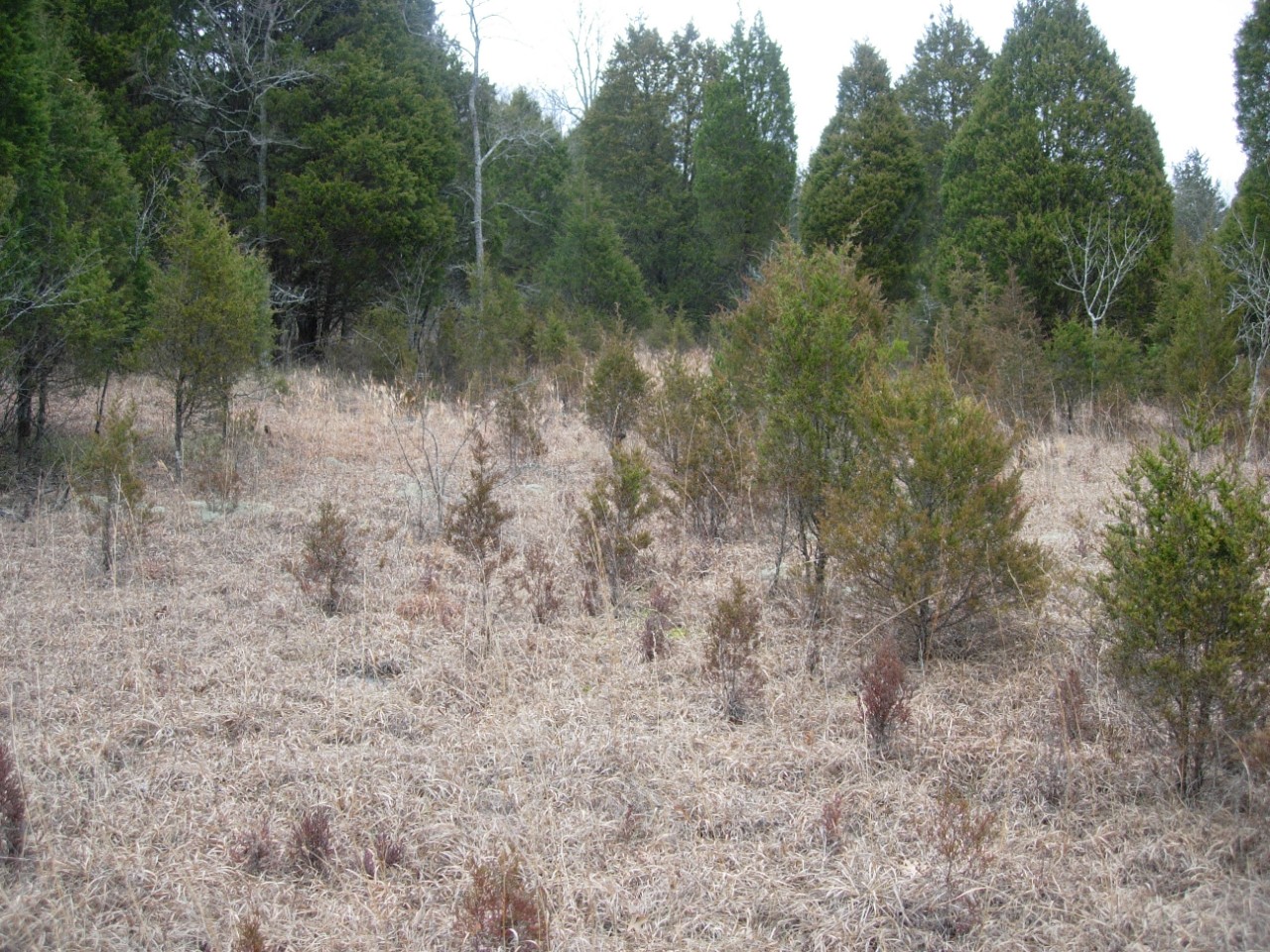
Fate Sanders Barrens is a 230-acre natural area in Rutherford County. It is located on Percy Priest Lake and is under the jurisdiction of the U. S. Army Corps of Engineers (US ACE). Its name derives from a nearby landmark, the Fate Sanders Marina. The natural area is significant because it supports a large open pristine barrens community comprised of perennial grasses and herbaceous plants. Little bluestem is widespread and is the dominant barrens plant here. Eastern red cedar is scattered throughout the barrens and is also a prominent feature. The grassland must periodically undergo prescribed burning to maintain the open condition. Fire keeps cedars and other woody plants from encroaching.
The deep soil that supports the barrens is also habitat for the Tennessee coneflower (Echinacea tennesseensis), which was delisted as a federally endangered species in September 2011. Fate Sanders serves as an introduction site for Tennessee coneflower. The coneflower at Fate Sanders is an introduction from a nearby population from private land. Its introduction is a means of protecting the only population of five known populations that occurs exclusively on private land. Colonies from the remaining four populations have been protected in state natural areas.
Other noteworthy plants at Fate Sanders include ladies tresses (Spiranthes lacera var. gracilis), limestone fame-flower (Talinum calcaricum), Tennessee milk-vetch (Astragalus tennesseensis), cleft phlox (Phlox bifida ssp. stellaria), and limestone blue star (Amsonia tabernaemontana var. gattingeri). Cedar glades occur intermittently where there is very shallow soil and limestone outcropping. A cedar hardwood forest occupies the slopes and dissected hilly areas on the northwestern third of Fate Sanders Barrens.
Site Management
U.S. Army Corps of Engineers, 3737 Bell Rd, Nashville, TN, 37214 phone (615) 889-1975; Division of Natural Areas, William R. Snodgrass Tennessee Tower, 312 Rosa L. Parks Avenue, 2nd Floor, Nashville, TN 37243 phone (615) 532-0431
Public Access
Open to the Public - Limited Access
Public parking and trails are not provided. This site is part of the Percy Priest Wildlife Management Area and is open for hunting under TWRA rules.
Parking: No
Trail: No
Dogs on Leash: Yes
Hunting: Yes
Fishing: Yes
Camping: No
Directions
From Nashville, take I-40 east and exit on Highway 171 then proceed south on Mt Juliet Rd. for approximately five miles, and then bear left on South Mt. Juliet Rd. for one half mile and turn left on Couchville Pike. Go approximately three miles and turn right onto Weakly Road and go three miles. Fate Sanders Natural Area is on the right just before you get to a bridge. There are no landmarks and the natural area along Weakly Road is wooded.
Details & Map
- Map to Fate Sanders Barrens
- Owned by the U.S. Army Corps of Engineers
- Gladeville 7.5-minute quadrangle
- Central Basin Physiographic Province
- Designated in 1999