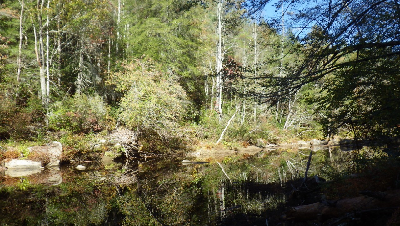
Rugby Class I Scenic-Recreational State Natural Area

Rugby is a 762-acre state natural area located southwest of the town of Historic Rugby in Morgan County on the Cumberland Plateau. Little Creek drains the property until it meets White Oak Creek, which then empties into the Big South Fork of the Cumberland River. The gorge topography here is much broader and flatter than typical gorges on the plateau and is much more like a large hollow, lacking the steep cliffs and rockhouses commonly associated with the plateau.
The forest includes tulip poplar, red maple, and sourwood with northern red oak, white oak, and hickories scattered throughout. White pine and Virginia pine can also be observed, although the pines have been severely affected by southern pine beetle infestation. American beech is present on both north and south facing lower slopes. The forest along Little Creek is comprised of tulip poplar, American beech, red maple, magnolia species, and an occasional red oak. The understory consists of hornbeam, flowering dogwood and saplings of beech, tulip poplar and red maple. The shrub layer has spicebush, sweet pepperbush (Clethra acuminata), blueberries, mountain camellia (Stewartia ovata), sweet azalea (Rhododendron arborescens), and seedling/saplings of the overstory species. The area is significantly affected by the invasive exotic species Japanese spiraea (Spiraea japonica) and other invaders such as multiflora rose. The natural area features several hiking trails maintained by the Historic Rugby community, including the featured Massengale Loop Trail which takes visitors to the remnant remains of an 1860s homestead, the first settlement in this area of the Cumberland Plateau.
Site Management
Historic Rugby, Inc, P.O. Box 8, 5517 Rugby Highway, Rugby, TN 37733, phone (423) 628-2441 or toll free (800) 214-3400. Division of Natural Areas - East TN office, 3711 Middlebrook Pike, Knoxville, TN 37921, (865) 594-5601. Division of Natural Areas, William R. Snodgrass Tennessee Tower, 312 Rosa L. Parks Avenue, 2nd Floor, Nashville, TN 37243, phone (615) 532-0431.
Public Access
Public access to the natural area is provided and parking is available at the trailhead for the Massengale Homeplace, which is located behind the Visitor’s Center in Historic Rugby. The hiking trail is about 1.2 miles roundtrip and takes visitors to the historic location of the Massengale Homeplace, a farming homestead dating back to the 1860s. A trail guide with historical notes is available at the Visitor’s Center, and there are interpretive panels at the trailhead and at the homeplace.
Parking: Yes
Trail: Yes
Dogs on Leash: No
Hunting: No
Fishing: Yes
Camping: No
Directions
From Knoxville take Interstate 75 north to exit 141 at Highway 63. Proceed west on Highway 63 approximately 20 miles (through Huntsville) to its terminus at Highway 27. Turn left (south) on Highway 27 for eight miles to Elgin. At Elgin, turn right (west) onto Highway 52, and proceed for seven miles to Rugby. An alternative and scenic route is through Oak Ridge, Oliver Springs, Wartburg, Sunbright to Elgin - turn left on Hwy. 52 and proceed as above. See also historicrugby.org for additional driving directions and information about Historic Rugby.
Details & Map
- Map to Rugby
- Owned by the State of Tennessee
- Rugby 7.5-minute quadrangle
- Cumberland Plateau Physiographic Province
- Designated in 2006