Hampton Creek Cove Class I Scenic-Recreational State Natural Area
PUBLIC NOTICE: Hampton Creek Cove State Natural Area is OPEN. The Birchfield Trail is CLOSED INDEFINITELY due to storm damage.

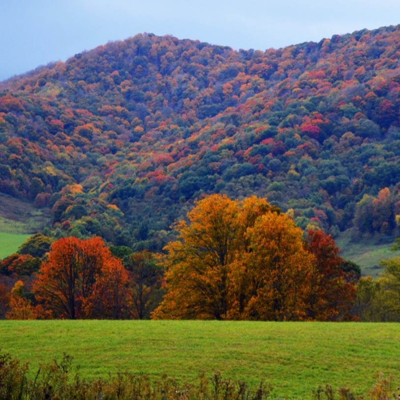
Hampton Creek Cove is a 693-acre natural area located in Carter County outside of the town of Roan Mountain and is very near Roan Mountain State Park. The Cove is in the Southern Appalachian mountains and lies between 3,000 to 4,800 feet elevation. The upper boundary is contiguous with the Cherokee National Forest just below where the Appalachian Trail (AT) crosses the Little Hump and Hump Mountains. The Cherokee NF is where the upper reaches of the Left Prong of Hampton Creek originate. The creek is a prominent feature bisecting the length of the natural area, draining young and mature forests, seeps, and farmland. The Left Prong is considered one of the most productive native brook trout streams in East Tennessee and has undergone brook trout restoration overseen by the Overmountain Chapter of Trout Unlimited and the Tennessee Wildlife Resources Agency. Seeps, which were once the source of drinking water here, are fairly common on the surrounding slopes.
Hampton Creek Cove is managed daily by the Southern Appalachian Highlands Conservancy (SAHC). SAHC is dedicated to the preservation of the ecological and cultural heritage of the Southern Appalachian Region. The conservancy retains a caretaker for the cove, a man and his wife who were born and raised in Hampton Creek Cove, who graze cattle and horses on approximately 100 acres of open pastureland. Fencing along the creek and other riparian restoration activities are used to demonstrate the compatibility of natural area preservation and agricultural practices. Past land use is apparent at places like the old Lenoir Shell cabin ruins, where you can see vestiges of a mature grove of butternut trees and remnants of stonewalls built in the late 1800s and early 1900s.
The abundant areas of old field and early forest succession provide excellent nesting habitat for golden-winged warblers, a rapidly-declining, neo-tropical migrant species. Because the area is so important to this warbler, the National Audubon Society designated it an “Important Bird Area” in 2005. The Birchfield Trail follows the Left Prong through pasture and forest making this a very popular birding location. Presently, the trail traverses a northern hardwood forest community on mid and upper slopes where yellow birch, striped maple, northern red oak, and tulip popular are dominant species. In partnership with the National Park Service and the Overmountain Victory Trail Association, two certified segments of the Overmountain Victory National Historic Trail are recognized inside Hampton Creek Cove. This trail retraces and protects the historic route of the Overmountain Men in their march to the Revolutionary War’s 1780 Battle of King’s Mountain. Hiking is also available on the Shell Hollow Trail, where you can enjoy carpets of white-fringed phacelia in the early spring and marvel at huge, old-growth trees.
No matter your vantage point from the trail at Hampton Creek Cove, you are sure to enjoy the bountiful history, flora, wildlife, heritage varieties of apples, and vistas which are of unequaled Southern Appalachian mountain heritage and beauty.
Site Management
Southern Appalachian Highlands Conservancy, 372 Merrimon Avenue, Asheville, NC 28801, phone (828) 253-0095; Division of Natural Areas – East TN Office, 3711 Middlebrook Pike, Knoxville, TN 37921, phone (865) 594-5601; Division of Natural Areas, William R. Snodgrass Tennessee Tower, 312 Rosa L. Parks Avenue, 2nd Floor, Nashville, TN 37243, phone (615) 532-0431.
Public Access
Open to the Public - Full Access
Parking. Trails. Hunting. Trout fishing. Bird-watching. Historic ruins and national historic trail. Access to the Appalachian Trail. Area open daily from sunrise to sunset. Hunting per TWRA regulations is limited to turkey, grouse, rabbit, squirrel, and deer hunting (tree stands prohibited and archery only) allowed. Hunting dogs, dog training and motorized vehicles are prohibited.
Parking: Yes
Trail: Yes
Dogs on Leash: Yes
Hunting: Yes
Fishing: Yes, observe TWRA creel regulations
Camping: No
Directions
From Elizabethton, Tennessee, take U.S. Highway 321/19E through Hampton, Tennessee and then continue on 19E to the Town of Roan Mountain. From the Town of Roan Mountain, take State Route 143 south toward Roan Mountain State Park. You will immediately cross a bridge over the Doe River. Just after that bridge, turn left onto Stratton Street. At the first stop sign, turn right, then bear left at the big curve on West Street and travel by the old commercial district buildings of Roan Mountain. Just past these old buildings, take the first right on Old Highway 143, then take the first left turn onto the bridge that crosses the creek (across from the old school building), and follow it to Hampton Creek Cove. The parking area is on the left not far past Gray’s Chapel Churche, approximately three miles from the Town of Roan Mountain.
Details & Map
- Map to Hampton Creek Cove
- Trail Map of Hampton Creek Cove
- Owned by the State of Tennessee
- White Rocks Mountain 7.5-minute quadrangle
- Blue Ridge Physiographic Province
- Designated in 1986