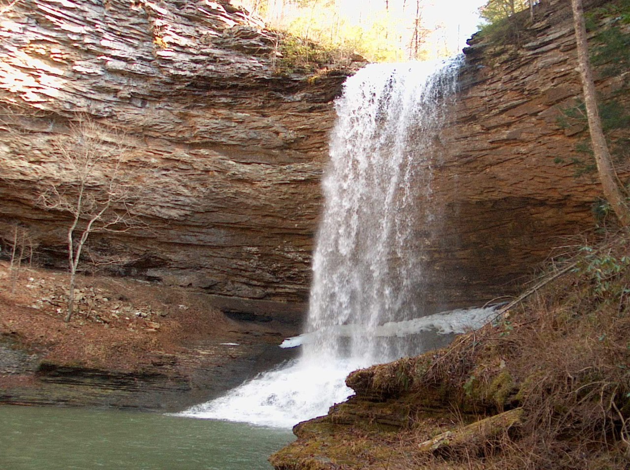
Piney Falls Class II Natural-Scientific State Natural Area

Piney Falls is a 818-acre natural area located in Rhea County where Little Piney and Soak Creek have carved deep gorges into the Cumberland Plateau. It is a pristine forest that features creeks, deep gorges, waterfalls and old growth forest. Piney Falls is also recognized by the United States Department of Interior as a National Natural Landmark. It is one of only fourteen National Natural Landmarks in Tennessee. These landmarks recognize the country’s best remaining examples of major biotic communities and geologic features.
Piney Falls is especially significant because of its old growth forest. The tallest and most magnificent trees are the white pines and eastern hemlocks that are found on lower slopes in the gorge below Lower Piney Falls. Many of these trees exceed 40 inches in diameter and are more than 100 feet in height. Large tulip poplar, hemlock, buckeye, and basswood also grow below Upper Piney Falls. The upland rim above the falls is composed of a typical plateau oak-pine forest.
Little Piney Creek drains the majority of the area plunging some 80 feet over the picturesque Upper Piney Falls into the pool below, and then drops another 40 feet over Lower Piney Falls. At Upper Piney Falls, a concave ledge circles behind and around the falls where visitors can follow a trail for an awe-inspiring view of the gorge below. Lower Piney Falls, which is smaller in stature, and not accessible by trail, plunges into a much narrower gorge. From here, the Little Piney Creek continues, and joins with Soak Creek State Scenic River before emptying into the Piney River.
Springtime visitors to the Soak Creek section of the natural area will see an abundance of wildflowers that include bloodroot, hepatica, crested iris, yellow wake robin, perfoliate bellwort, and spotted geranium. The old growth forest structure, diversity in species composition, and picturesque waterfalls provide scenic value and ecological significance.
Site Management
Cumberland Trail State Park, 220 Park Road, Caryville, TN 37714 phone (432) 566 - 2229. Division of Natural Areas, William R. Snodgrass Tennessee Tower, 312 Rosa L. Parks Avenue, 2nd Floor, Nashville, Tennessee 37243, phone (615) 532-0431. Division of Natural Areas - East TN office, 3711 Middlebrook Pike, Knoxville, TN 37921, phone (865) 594-5601.
Public Access
Open to the Public - Full Access
Parking. Hiking trail. Area is open sunrise to sunset. Access is foot traffic only. No Camping. Additional information for camping on the Cumberland Trail:
www.friendsofthecumberlandtrail.org
Parking: Yes
Trail: Yes
Dogs on Leash: Yes
Hunting: No
Fishing: Yes
Camping: No
Directions
Piney Falls Access: From Spring City take State Route 68 north toward Crossville, or from Crossville travel south on S.R. 68. As you get to the crest of the Cumberland escarpment, you enter the unincorporated town of Grandview. Look for a sign for Piney Falls State Natural Area and turn onto the Fire Tower Road (a.k.a., Hillary Road). The trailhead is on the right approximately one mile from Highway 68 or one-fourth mile before you get to the fire tower, which is located at the end of the road.
Soak Creek Access: From Spring City, take State Route 68 north toward Crossville, or from Crossville travel south on S.R. 68. Look for a convenience store near the bridge over the Piney River. On the same side of S.R. 68 as the convenience store, the first cross street is Shut-In-Gap Road. Turn on there and travel about 1 mile to a parking area on the right by a picnic area at the Piney River. Park here for access to Soak Creek, which is a short walk continuing up Shut-In-Gap Road, across the bridge over the Piney River, to a gated jeep trail going up Soak Creek.
Details & Map
- Map to Piney Falls
- Owned by the State of Tennessee
- Spring City & Pennine 7.5-minute quadrangle
- Cumberland Plateau Physiographic Province
- Designated in 1973