Alcoa Highway (State Route 115, US 129)
Blount and Knox counties
The Tennessee Department of Transportation (TDOT) is contructing major improvements to Alcoa Highway (State Route 115, US 129) in Knox and Blount counties. Alcoa Highway is a major connection between the City of Knoxville and the Cities of Alcoa and Maryville and provides a route to McGhee Tyson Airport and the Great Smoky Mountains National Park. The section between State Route (SR) 35 (Hall Road) and South Singleton Station Road serves multiple functions for commuters, local businesses, and airport traffic. The contrasting priorities along this section and the remainder of the corridor have resulted in negative safety and capacity issues.
The improvements are intended to address transportation needs including capacity, geometric deficiencies and safety issues throughout the corridor, which have been identified through coordination with local officials, agencies, and the public. The improvements for SR 115 (US 129/Alcoa Highway), from SR 35 (Hall Road) to Cherokee Trail, in Blount and Knox Counties, consist of reconstruction and widening for approximately 13 miles.
Due to the size of the Alcoa Highway project, TDOT has split this project into seven segments. Two segments are complete. Three segments are currently under construction, and a sixth is identified for funding in TDOT's 10-Year Project Plan.
Estimated construction start: Varies
Estimated completion*: Varies
Funding Source: TDOT anticipates that future phases will be funded in part through the Transportation Modernization Fund.
Current Status: July 8, 2025
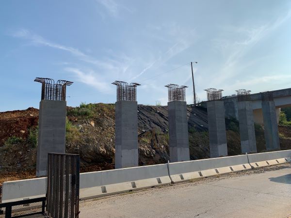
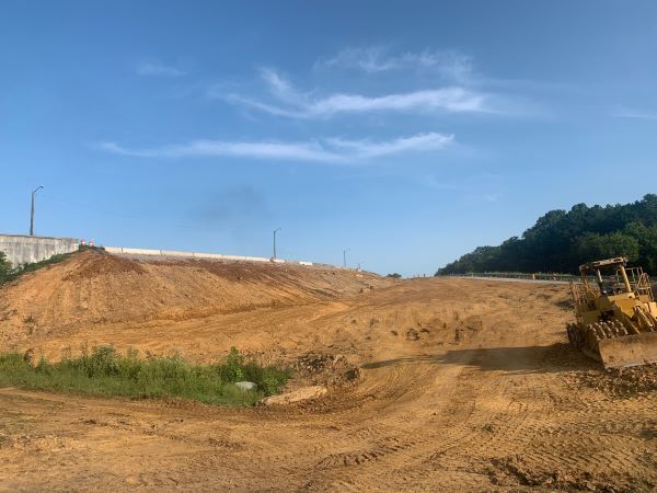
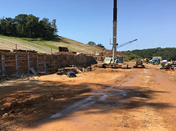
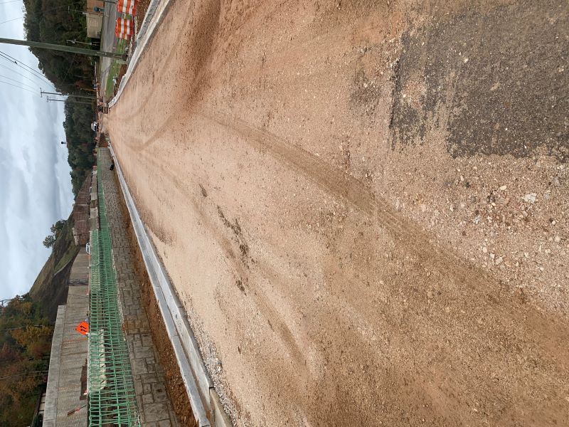
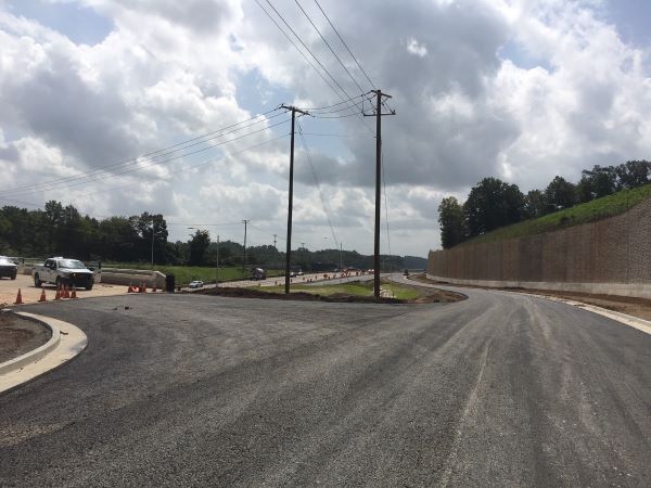
Alcoa Highway at Cherokee Trail: Bridge 1 and 2 abutments continue to be constructed. Production blasting and presplit blasting continue for retaining walls and ramp B/C. Installation of storm structures continues on Lifestar Road and Cherokee Trail. Installation of electric poles and lines continue along Alcoa Highway. Crews continue construction of walls 2, 6, 7, 8 and 19-24.
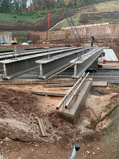
Alcoa Highway at Topside Road: Crews completed Bridge 3 and 4 deck pours. Crews near completion of walls 7 and 7B near bridge 3. A traffic shift for John Sevier ramps continues as all ramps are being tied in.
Relocated Alcoa Highway: Completed the substructure and forming superstructure of bridge 2 at Regal Drive. Buidling substructure of bridge 4 over Pellissippi Parkway. Constructing a double barrel box culvert near Amazon. Building MSE retaining wall 4. Completed water line and contiuing with sanitary sewer, communication and electrical infrastructure. Earthwork ongoing on future Pellissippi ramps near Amazon. Paving on Wright Road.
Due to the significant size of the SR 115 (US 129/Alcoa Highway) project, the improvements have been separated into seven smaller sections or phases. The chart below is a summary of the current status of each section.
| Blount County | ||
|---|---|---|
| From north of SR 35 (Hall Road) to proposed interchange at Tyson Boulevard |
Complete | Summer 2022 |
| (Relocated Alcoa Highway) from proposed interchange at Tyson Boulevard to SR 115 at South SIngleton Station (Phase 1) |
Construction | Estimated completion Fall 2027 |
| (Relocated Alcoa Highway) from proposed interchange at Tyson Boulevard to SR 115 at South SIngleton Station (Phase 2) |
Construction | Scheduled Fiscal Year 2028 |
| From South Singleton Station to south of Little River |
Construction | TBD |
| Knox County |
||
| From south of Little River to north of Maloney Road |
Construction | Estimated completion Summer 2025 |
| From north of Maloney Road to Woodson Drive |
Complete | Summer 2023 |
| From Woodson Drive to Cherokee Trail Interchange |
Construction | Estimated completion Fall 2027 |


History and Background
The section referred to as "Relocated Alcoa Highway," between SR 35 (Hall Road) and South Singleton Station Road, will shift the alignment to the east of the existing roadway. The new alignment will be a four-lane, controlled-access facility, allowing for two lanes in each direction with no signals or intersections. The newly-constructed roadway will separate local traffic from commuter through-traffic, while the existing facility will continue to provide access to local businesses.
A new interchange will be constructed near SR 335 (Hunt Road) to provide access to McGhee Tyson Airport West Aviation area, Hunt Road, and the City of Alcoa’s planned development, Springbrook Farm.
New interchanges will be constructed at the entrance of McGhee Tyson Airport and Wright Road. Both interchanges will provide access to the section of existing Alcoa Highway referred to as the Motor Mile. The Wright Road interchange will also provide access to Cusick Road.
A new interchange will be constructed at SR 162 (Pellissippi Parkway) to provide continuous movements between Relocated Alcoa Highway and Pellissippi Parkway.
A new pedestrian greenway will be also constructed along sections of Hunt Road, Wright Road, and Cusick Road.

Public Involvement and Engagement
A Design Public Meeting was held on Thursday, February 12, 2015, at Alcoa Service Center, Alcoa, Tennessee, from 5:00 to 7:00 pm. The purpose of the meeting was to gather public input for the section of SR 115 from SR 35 (Hall Road) to the proposed interchange at Tyson Boulevard.
Public Meeting Presentation (PowerPoint)
Public Meeting Display (PDF)
A Design Public Meeting was held on Thursday, May 18, 2017, at Alcoa Service Center, Alcoa, Tennessee, from 5:00 to 7:00 pm. The purpose of the meeting was to gather public input for the sections of SR 115 from the proposed interchange at Tyson Boulevard to SR 162 (Pellissippi Parkway) and SR 115 from SR 162 (Pellissippi Parkway) to south of Singleton Station Road.
Public Meeting Presentation (Video - YouTube)
Public Meeting Display (PDF)
A Design Public Meeting was held on Tuesday, December 4, 2018, at Sevier Heights Baptist Church (North Campus), Knoxville, Tennessee, from 5:00 to 7:00 p.m. The purpose of the meeting was to gather public input for the section of SR 115 from Singleton Station Road to south of the Little River.
Public Meeting Handout (PDF)
Public Meeting Presentation (Video - YouTube)
Public Meeting Display (PDF)
A Design Public Meeting was held on Tuesday, December 8, 2015, at Sevier Heights Baptist Church, Knoxville, Tennessee, from 5:00 to 7:00 p.m. The purpose of the meeting was to discuss the roadway plans for the section of SR 115 from north of Little River to Maloney Road.
Project Information Sheet (Word)
Public Meeting Presentation (PowerPoint)
Public Meeting Displays (PDF)
A Design Public Meeting was held on Tuesday, December 6, 2016, at Sevier Heights Baptist Church (North Campus), Knoxville, Tennessee, from 5:00 to 7:00 p.m. The purpose of the meeting was to gather public input for the section of SR 115 from Woodson Drive to Cherokee Trail interchange.
Public Meeting Handout (PDF)
Public Meeting Presentation (PowerPoint)
Public Meeting Displays (PDF)

Project Imagery & Visuals
Alcoa Highway Little River to Cherokee Trail Flythrough Animation: https://www.youtube.com/watch?v=0euPAngFiGg
Click here for a detailed, clickable map of the Cherokee Trail to Woodson Drive corridor.
- Panoramic view of cut are between Barber Hill Lane & Mt Vernon Drive
- Hilltop view of retaining wall construction between Barber Hill & Mt Vernon Drive
- Street level view of retaining wall construction between Barber Hill & Mt Vernon Drive
- Bridge construction at Mt Vernon Drive over Alcoa Highway
- Frontage road construction near fitness center & shopping strip
- Greenway construction near frontage road
- Bridge & frontage road construction near Mt Vernon Drive
- Bridge view looking northbound towards Montlake Drive
- Frontage Road construction connecting Montlake Drive & Barber Hill Road
Videos:
- Construction update – August 29, 2016
- Alcoa Highway Improvements Groundbreaking Ceremony - June 24, 2016
- Construction Update - May 31, 2016
- Travel Path - May 2, 2016

.jpg)

Key Project Milestones


Project Materials
- Construction of two new roundabouts
- Construction of two bridges
- Construction of 23 retaining walls
- Lighting upgrades
- Utility installation and relocation
- Traffic signal upgrades
- SmartWay traffic connectivity
- Rock excavation
The project will widen the existing roadway for approximately 1.6 miles increasing the roadway to six lanes (three in each direction) and modifying the existing interchange at Cherokee Trail and the UT Medical Center. The improvements will increase capacity, correct roadway deficiencies and provide upgrades to lighting, signals and SmartWay Traffic systems.
During phase 1, construction activities will predominately take place outside of the existing lanes. Motorists should expect to see channelizing devices throughout the project. A barrier wall and safety fencing are to be placed along the outside shoulders. Changes to alignments throughout the project will be communicated in advance.
Modifications will be made to the Cherokee Trail/Alcoa Highway Interchange. These changes will include new entrance and exit ramps as well as new signalized intersections. TDOT has made every effort to plan the construction of the interchange in such a way as to maximize construction work outside of existing roadways and minimize any work that might impact the roadways providing access.
Access to all businesses, recreational areas and service providers within the project will be always maintained throughout the project.
The contractor will be reconstructing Lifestar Road in three phases over 12 months in phase 1 construction.
Lane closures for overnight work are anticipated. Uniformed officers will be present. Rolling roadblocks are anticipated during daytime non-peak hours.
Local roadways, streets and interchanges will be kept open to the greatest extent possible.
Changeable message signs will be utilized for motorist notification for traffic impacts.
Notice of activities will be posted to the project web page and shared through email communication.
A greenway will be constructed from Marine Park to Montlake Drive to provide a connection to the Knox-Blount Greenway along Alcoa Highway.
The project will implement a Smart Work Zone, much like that of the TDOT SmartWay system utilizing cameras, radar and message boards. This system will be utilized to alert motorists of any unexpected delay.
Yes, a portion of the rock bluff along the northbound lanes will require blasting to aid in its removal to widen this section.
A licensed professional blaster is responsible for the blasting performed on the project. This portion of work will consist of controlled blasts necessary to allow the contractor to remove the rock within the designated area.
According to state regulations, surface blasting operations will only be conducted during daylight hours.
Rolling roadblocks will be utilized by the contractor to establish appropriate clear zones while blasting is performed. Rolling roadblocks should be anticipated to last approximately 20 minutes. TDOT has limited these activities to off-peak hours to further minimize any impacts to traffic.
Blasts are not typically felt outside of the immediate area. Most of the energy from the blast will be absorbed and used to break rock, but some energy will travel from the blast site in the form of ground and air waves.
Properties nearby may feel a slight vibration or hear noise similar to a thunderstorm. Blasts will be kept to a manageable size to minimize unnecessary disruption or concern. Blasters will also follow regulatory protocol to ensure safety.
TDOT will provide regular updates through the project website, email communication, media announcements and community outreach. Specific questions can be emailed to TDOT.US129@tn.gov.
For more information and to receive updates on this project, please enter your name and email address.
Project Contacts
Mark Nagi
TDOT Region 1 Regional Communications Officer (media)
Phone: 865.594.0161
Email: Mark.Nagi@tn.gov
Blount County
For projects under construction:
Wade Lawhorn
TDOT Region 1 Team Lead
Phone: 865.981.2368
Email: Wade.Lawhorn@tn.gov
For projects under development:
Stacy Weaver
TDOT Region 1 Roadway Design Manager
Phone: 865.594.2442
Email: Stacy.Weaver@tn.gov
Knox County
For projects under construction:
Matthew Edens
TDOT Region 1 Team Lead
Phone: 865.594.2449
Email: Matthew.Edens@tn.gov
For projects under development:
Eric Wilson
TDOT Region 1 Project Development Manager
Phone: 865.594.0742
Email: Eric.Wilson@tn.gov
*Subject to change