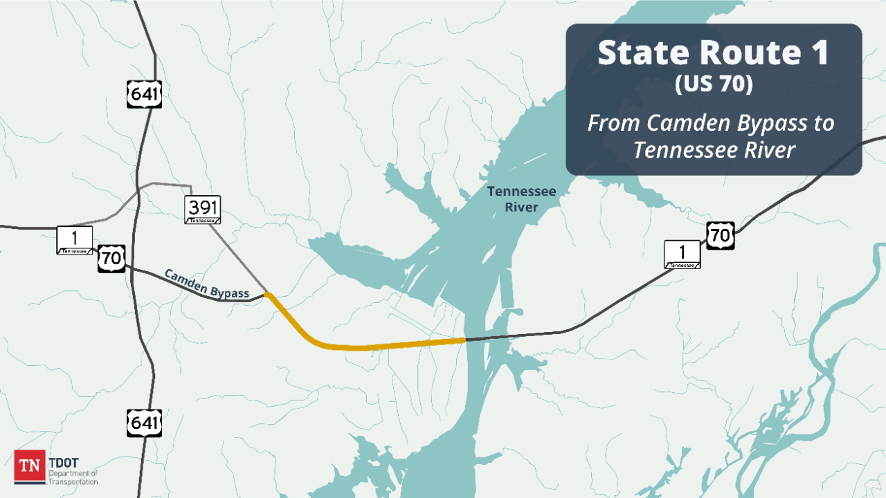
State Route 1 (US 70)
Benton County
The Tennessee Department of Transportation is proposing to make improvements to State Route 1 (US 70) in Camden, in Benton County, Tennessee. This project will connect the Camden Bypass to the four-lane bridge over the Tennessee River at New Johnsonville. The project will widen approximately 4.01 miles of SR 1 to a five-lane undivided roadway and realign intersections to provide safer connections.
This project was initiated at the request of local and state elected officials, citing the need for a more efficient transportation system to enhance economic development in this portion of West Tennessee. This project will aid in the movement of traffic and goods in the project impact area while providing local and regional travelers with improved operating conditions.
This project is identified for funding in TDOT's 10-Year Project Plan, with construction scheduled in Fiscal Year 2025.
The project has a specific "no work" period from November 1st to February 15th each year within the newly acquired permanent easement within the TVA/TWRA property. During this time, all boat ramps and sloughs must be open, navigable, and passable and no work can occur below the winter pool elevation. Additionally, there are 8-day "no work" periods during the Tennessee Wildlife Resources Agency's late waterfowl hunting seasons. Outside these periods, public access to the TVA/TWRA property may be impeded. To keep the public informed, the contractor shall implement a communication plan approved by the engineer. Once the construction work has exceeded the winter pool elevation, the contractor will be authorized to continue construction activities within the existing state-owned Right-of-Way.
Current Status: Under construction
Estimated construction start: August 12, 2025
Estimated completion*: October 31, 2029
Funding Type: SR 1 is an Improve Act (IA) and Transportation Modernization Act (TMA) project and is funded 50% traditional Federal/State dollars and 50% TMA dollars.

History and Background
The existing route is a two-lane roadway that is classified as a major arterial route on the State Highway system. The widening of SR 1 is composed of two sections:
From the beginning of the project to the Highway 70E Access Road, SR 1 will be widened to an undivided 5-lane curb and gutter roadway with sidewalks.
From the Highway 70E Access Road to the end of the project, SR 1 will be widened to an undivided 5-lane roadway with open shoulders. Within this section, starting near Brook Lane, the road alignment will shift 18’ to the north and will continue to the end of the project.
The Advanced Planning Report (APR) was approved on March 29, 1993. The proposed curb and gutter roadway section was designed as recommended in the APR. The APR provided two alternatives for open shoulder roadway section within the project. Alternate A recommended the same roadway typical section and alignment shift to the north as described above. Alternate B recommended the same roadway typical section as described above, but with an alignment shift to the south. Alternate B was the original recommendation because it would have affected less tracts and resulted in less utility and right-of-way expenses.
Once the project entered the design phase, it was determined that Alternate B would have a greater overall impact on the environment than Alternate A. Due to this determination, Alternate A became the preferred design for the project. The project was developed using the preferred design. In July of 2011, the plans were submitted for right-of-way (ROW) acquisition and appraisals.
In 2013, TDOT recommended an Expedited Project Delivery (EPD) review of the project. The purpose of this review was to identify and recommend improvement options that are feasible, cost effective, and provide improved safety and mobility through the proposed project’s corridor.
In May of 2017, a Record of Decision, stemming from the EPD review, was handed down with a recommendation to continue with the original design that was submitted for ROW.

Public Involvement and Engagement
A Public Informational Meeting was held on June 4, 2009, at the Camden Junior High School, 75 Schools Drive in Camden, TN. The purpose of the meeting was to allow the public to view project displays in the early stage of the preliminary plan’s development and answer questions.
A public design meeting was held on July 8, 2010, at Camden Central High School, 115 Schools Drive, Camden, TN. The purpose of the meeting was to review and comment on the preliminary plans. 58 people attended the meeting.

Project Imagery & Visuals

Environment
On May 26, 2010, a D-List Categorical Exclusion (CE) environmental document was approved. Due to the amount of time that had lapsed after the original document was approved, a reevaluation of the environmental document was required and approved by the FHWA on September 19, 2022.

Key Project Milestones
Advanced Planning Report approved – March 1993
Public Information Meeting – June 2009
D-List Categorical Exclusion (CE) Environmental Document approved – May 2010
Public Design Meeting – July 2010
Right-of-Way Appraisal/Acquisition began – July 2011
EPD Record of Decision – May 2017
D-List C.E. Reevaluation Approved – September 2022
Project Contacts
Nichole Lawrence
TDOT Region 4 Regional Communications Officer (Media)
Phone: 731.935.0318
Email: Nichole.Lawrence@tn.gov
Seth Hendren
TDOT Region 4 Project Management
Phone: 731.935.0143
Email: Seth.Hendren@tn.gov
Ross Sherwood
TDOT Region 4, District 47 Manager
Phone: 731.234.9659
Email: Ross.Sherwood@tn.gov