Interstate 69 Corridor
West Tennessee
The Tennessee Department of Transportation (TDOT) is working to construct projects along the proposed Interstate 69 Corridor in West Tennessee. I−69 was identified as a priority by the U.S. Congress, with a goal to provide improved mobility and modal connections and to facilitate economic development along the proposed corridor, which extends from Port Huron, Michigan, to the Texas border.
At present, four projects along the future I-69 Corridor in West Tennessee are complete, forming a bypass around Union City; a fifth, beginning at the US 51 interchange with US 45 in Tennessee and stretching into Kentucky, is identified for funding in TDOT’s 10-Year Project Plan, with construction scheduled in Fiscal Year 2028. Once completed, these five projects will form a usable portion of Future I-69 in Tennessee, connected to Future I-69 in Kentucky.
Current Status: Four projects in Obion County are complete. A fifth project, which will connect Future I-69 in Tennessee with Future I-69 in Kentucky, is under development.
Right-of-Way (ROW) funding was obligated on 8/15/25, and the project is now in the ROW acquisition phase.
Estimated construction start: The segment connecting Future I-69 in Tennessee with Future I-69 in Kentucky is scheduled in TDOT’s 10-Year Project Plan to begin construction in Fiscal Year 2028.
Estimated completion*: TBD
Funding Type: TDOT anticipates that this project will be funded in part through Traditional Federal/State dollars.

History and Background
I-69 is an integral part of High Priority Corridor 18 across mid-America. Corridor 18 originated with the Intermodal Surface Transportation Efficiency Act of 1991 (ISTEA), where the U.S. Congress designated certain highway corridors of national significance to be included in the National Highway System. I-69 currently exists from the Michigan/Canada border to the northeast side of Indianapolis, Indiana. Congress passed legislation to extend the corridor from Indianapolis to the Lower Rio Grande Valley.
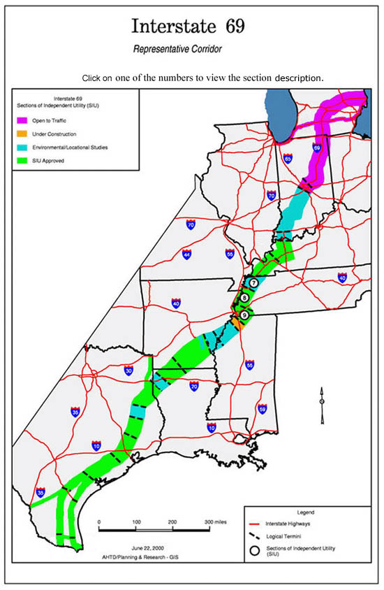
The proposed route has been divided into multiple segments, three of which impact the state of Tennessee.
· Segment 7 (Fulton, KY to Dyersburg, TN)
· Segment 8 (Dyersburg, TN to Millington, TN)
· Segment 9 (Millington, TN to Hernando, MS)
There is no existing interstate facility within Corridor 18 for the full distance from Indianapolis to the Texas/Mexico border. This missing interstate link is in a corridor that has a high demand for North American Free Trade Agreement (NAFTA)-associated goods movements. Short- to medium-length trips, however, far outnumber international traffic along the corridor. There will be local and regional trips that will take advantage of an improved facility designed to Interstate highway standards. By diverting these local trips to the I-69 Corridor, the adjacent state and federal highways will likely see a drop in overall traffic levels with attendant increases in travel efficiency and motorist safety.
Throughout its length, I-69 would connect 16 existing Interstate highways crossing Corridor 18 (10 east-west routes and 6 north-south routes). It would link 10 urban areas of more than 50,000 population along the corridor. Within urban areas, development of I-69 could provide the means to upgrade existing Interstate routes, connect major transportation corridors and radial freeways with a new facility, and connect modal and multi-modal terminals to the Interstate highway network.
TDOT Projects on Interstate 69
TDOT recently completed a series of projects on Future I-69 in Obion County that form a bypass around Union City. This new route, currently designated State Route 690, was opened to traffic in early 2024.
An additional project, which is currently under development, is approximately two miles in length and crosses the Tennessee/Kentucky state line, connecting the proposed Interstate 69 (I−69) Section of Independent Utility (SIU) 7 in Tennessee with the proposed I−69 SIU 6 in Kentucky. SIU 6 begins at Eddyville, Kentucky, and extends south approximately 65 miles to the city of Fulton, Kentucky; SIU 7 begins at South Fulton, Tennessee, and extends south approximately 49 miles to Dyersburg, Tennessee. This project, SIU 7, and SIU 6 are all within the larger I−69 “Corridor 18,” which extends from Port Huron, Michigan, to the Texas/Mexico border.
Two alternatives near Fulton/South Fulton were initially studied as the northernmost portion of SIU 7, presented in its Draft Environmental Impact Statement (EIS): one generally following US 51 and another on new alignment further west of the cities. The new alignment option met with substantial public opposition; as a result, the northern terminus of SIU 7 was shifted from the US 51/Purchase Parkway interchange to the US 51/US 45E/US 45W interchange in the Final EIS. This two-mile gap between SIU 6 and SIU 7 forms the termini for the current environmental document.
Specifically, the proposed project addressed herein begins in Tennessee, just west of the US 51/US 45E/US 45W interchange and extends approximately two miles northeast to the western ramps of Exit 1 of the Purchase Parkway at the US 51/Nolan Avenue interchange in the northwest portion of the city of Fulton. US 51, which currently follows two ramps of the US 51/US 45E/US 45W interchange, must become the through movement to become I−69, requiring some degree of realignment. The Preferred Alternative (Alternative 2C) generally follows the existing US 51 alignment, creating a new sweeping curve to the east near Kentucky SR 116 (State Line Road) and reconstructing the US 51/US 45E/US 45W interchange at its existing location.
Approaching the state line, conversion of US 51 to I−69 requires reconfiguration of the existing highway system to create a high−speed through movement for the proposed interstate corridor. Two single lane ramps at the US 51/US 45E/US 45W interchange currently serve the movements that would become I−69 through movements northbound and southbound. Geometric improvements are necessary to satisfy design guidelines for the interstate system: number of lanes, design speed, etc.
Locally, the project would improve linkages to the existing transportation systems; provide an interstate−level facility linking the project area to I−155 at Dyersburg, I−55/I−40 at Memphis, and I−57 north of Cairo, Illinois; and reduce the through truck traffic on existing US 51.
A Public Meeting was held in 2015 with two proposed alignment alternatives and a no-build option. The Alternative 1 alignment was located just west of the current interchange of the US 51 Fulton Bypass and US 45E. Alternate 1 began on US 51/US 45W in Obion County, Tennessee just west of the Rogers Road overpass and projected north crossing the Tennessee/Kentucky state line and terminated along the existing US 51 (Purchase Parkway) corridor in Fulton, Kentucky just west of the current US 51/Nolan Avenue interchange. The Alternate 2 alignment began along existing US 51/US45W just west of the Old Pierce Road overpass and extended to east of the existing US 51/US 45E/US 45W interchange in a northerly direction on new alignment crossing the Tennessee/Kentucky state line and terminated along the US 51 (Purchase Parkway) corridor just north of the Tennessee/Kentucky state line in Fulton, Kentucky. Alternate 2 had a proposed diamond interchange located at Stateline Road. The Alternate 1 alignment option further to the west was met with substantial public opposition and as a result the Alternate 2 alignment was carried forward to the environmental document. Ultimately the Alternate 2 alignment was modified to the current preferred Alternate 2C by eliminating the proposed interchange at Stateline Road and reconfiguring the existing interchange at US 51/US 45W/US 45W.
Interchange concurrence and PE/NEPA funds were approved in 2018, which resulted in an approved Categorical Exclusion Level 3 environmental document in 2020.
A Bi-State Agreement between Tennessee and Kentucky was established in 2022 for preliminary engineering of the Alternate 2C alignment.
A Topographic Ground Survey was completed in 2023.
A project kick-off meeting and site visit were held in November 2023. After the kickoff, the TDOT project team had a traffic analysis prepared and performed a more thorough investigation of Alternative 2C. Based on the results, the TDOT team decided to update the design to better accommodate future traffic and provide a safer facility. The new design will have 3 roundabouts along SR 215 (US 45E). Two will serve the ramps for the future I-69 diamond-type interchange along with incoming traffic from SR 214. The third will connect Holiday Lane, S.R. 215 (US 45E), and W. State Line Street together.

Public Involvement and Engagement
A public meeting for segment five was held in December 2015 in South Fulton to present Alternatives 1 and 2. The Alternative 1 alignment was located just west of the current interchange of the US 51 Fulton Bypass and US 45E. Alternate 1 began on US 51/US 45W in Obion County, Tennessee just west of the Rogers Road overpass and projected north crossing the Tennessee/Kentucky state line and terminated along the existing US 51 (Purchase Parkway) corridor in Fulton, Kentucky just west of the current US 51/Nolan Ave. interchange. The Alternate 2 alignment began along existing US 51/US45W just west of the Old Pierce Road overpass and extended northeast from the existing US 51/US 45E/US 45W interchange on new alignment crossing the Tennessee/Kentucky state line and terminated along the US 51 (Purchase Parkway) corridor just north of the Tennessee/Kentucky state line in Fulton, Kentucky. Alternate 2 had a proposed diamond interchange located at Stateline Road. Based on sign in sheets, 46 individuals attended the meeting. The Alternate 1 alignment option further to the west was met with substantial public opposition and as a result the Alternate 2 alignment was carried forward to the environmental document. Major themes suggested an alternative closer to town would minimize economic disbenefits and right−of−way impacts and improve traffic flow.
TDOT, in conjunction with KYTC, held a Design Public Meeting on March 20, 2025, at the South Fulton Middle and High School. Based on sign in sheets, 164 individuals attended the meeting. Displays boards and roll plots were set up showing the public the updated design that the project team has been working on since the project kickoff. TDOT is currently reviewing the public comments from the meeting.
Public Meeting Scheduled- March 20, 2025


Environment
A Categorical Exclusion – Level 3 for the proposed project was completed and approved by the Federal Highway Administration, the Kentucky Department of Transportation, and the Tennessee Department of Transportation on October 2, 2020, for the project in Obion County TN and Fulton County KY that reconstructs the US 51/US 45E/US 45W interchange.
TDOT is currently in the process of developing its own environmental document.
The D-List Categorical Exclusion was approved by FHWA on 7-16-2025.
Project Contacts
Nichole Lawrence
TDOT Region 4 Regional Communications Officer
Phone: 731.935.0318
Email: Nichole.Lawrence@tn.gov
Seth Hendren
TDOT Region 4 Project Management
Phone: 731.935.0143
Email: Seth.Hendren@tn.gov