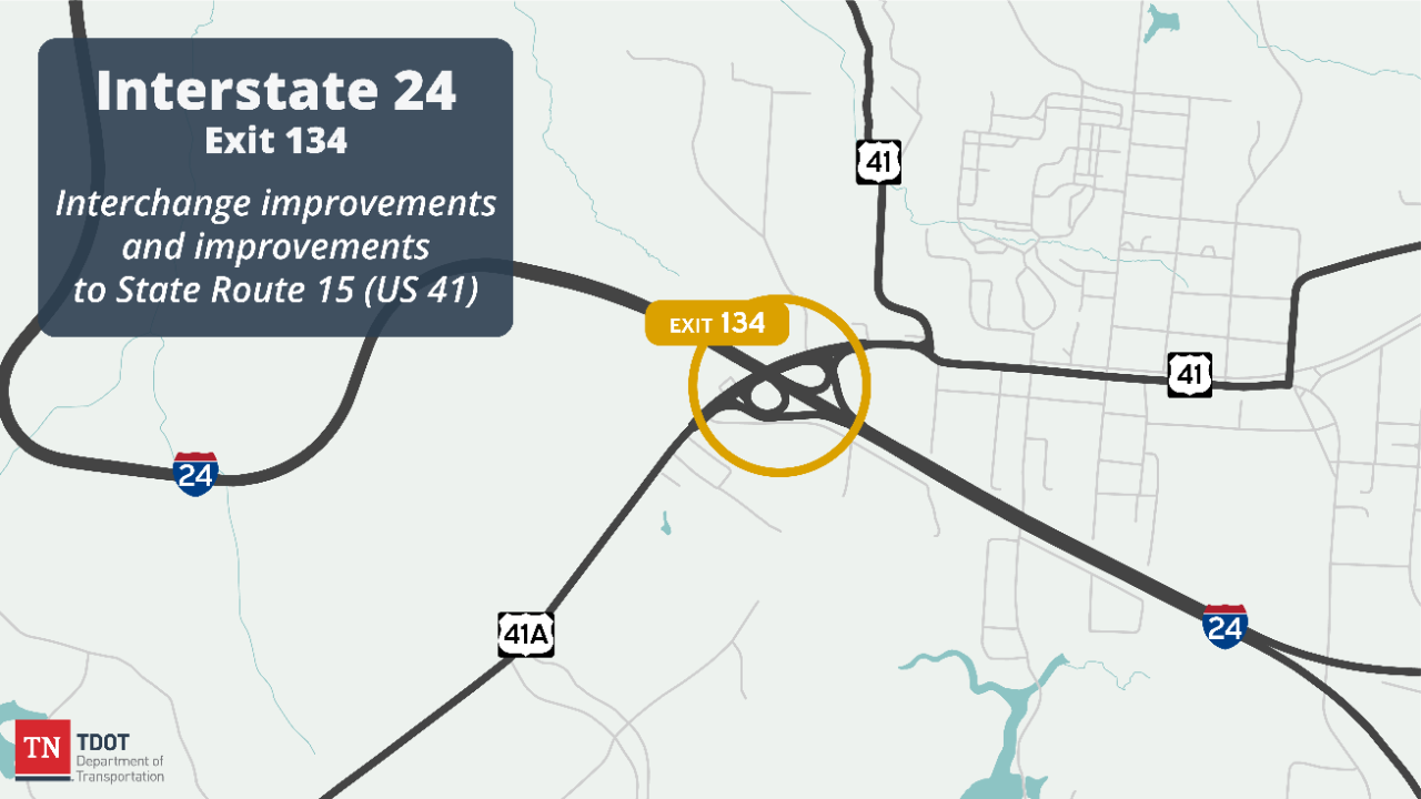
Interstate 24 Interchange at State Route 15 (Exit 134)
Marion and Grundy counties
This project is a Rural Interchange Improvement Program project proposed in the Governor’s Fiscal Year 2023 budget. The intent of the program is to modernize and rehabilitate interchanges which have largely remained unchanged since construction in the 1960s. Several recommendations are being developed to realize the vision of the Rural Interchange Improvement Program, preparing the interchange for decades to come.
The proposed project includes modifications to SR 15 (US 41), extending Mountain Goat Trail and modifying I-24.
Current Status: The project recently advanced through the completion of an Environmental Document and will proceed with Right of Way acquisition, utility coordination, and permitting.
To better understand and address potential construction issues, TDOT has advertised for a Constructability Review. This provides an opportunity for highway contractor's to review and provide input on project challenges in advance of advertisement for construction.
Information about the Constructability Review is available here on TDOT's Construction webpage.

History and Background
The project is within Monteagle and provides access to Sewanee and Winchester to the southwest. The interchange also offers a detour route north to Pelham along US 41, which parallels I-24. Exit 127 at SR 50 is 7 miles to the northwest and Exit 135 is 1.5 miles to the east. This interchange is the last westbound exit before descending approximately 800-ft along steep grades. A rest area is present to the west and an eastbound truck inspection station is to the east.
The project team has re-evaluated the bridge Transportation Investment Report from 2020 with additional focus on interchange configuration, ramp terminal operations, multimodal users, maintenance concerns, SR-15 operations and crash history. Several recommendations are being developed to realize the vision of the Rural Interchange Improvement Program, preparing the interchange for decades to come.
SR 15 (US 41) Proposed Modifications
The existing SR 15 roadway, beginning to the west, is 3-lanes with shoulders which widens out to 4-lanes and a grassed median though the interchange before tapering back to a 3-lane curbed section which continues east. In early 2010’s the roadway between US 41 (Dixie Highway) and Dubose Street was 5-lanes prior to being restriped to remove one lane in each direction and provide a bicycle lane and additional buffer to the sidewalks.
SR 15 will be reconstructed, including curb and gutter, throughout the interchange area The pair of bridges will be replaced with a single bridge, and the railroad bridge to the north will be demolished. Intersection control at the I-24 ramps will be converted from stop control/flashing beacon to roundabouts.
Mountain Goat Trail
The Mountain Goat Trail will be extended for the limits of the interchange project, starting near Moss Circle and continuing to US-41 (Dixie Highway), along the north side of SR-15. The trail will be further extended east to Dubose Street by the town with a Multi-Modal Access Grant as a separate project.

Project Imagery and Visuals


Public Involvement and Engagement
The Tennessee Department of Transportation (TDOT) hosted a public informational meeting on September 11, 2025, to gather public input on the SR-15 at I-24 Interchange Project in Marion and Grundy County, I-24 Exit 134. The meeting was held to provide the public with information about the project, including the proposed work and schedule and provide an opportunity to provide comments regarding this project. Anyone with questions regarding the meeting should contact:
Mr. Michael O’Donnell, P.E.
7512 Volkswagen Drive, Building A
Chattanooga, TN 37421
(423) 634-8622
Michael.Odonnell@tn.gov
Public Info Meeting Materials:
Comment Card
Public Info Meeting Presentation (9/11/15)
Peanut Roundabout Map
Roundabout Map Mountain Goat Trail Project Overview with Parcel Lines Project Overview without Parcel Lines

Key Project Milestones
Concept Complete Fall 2024
Environmental Document Completed on June 4, 2025
Right-of-Way Acquisition Began Summer 2025
Construction Begin Spring 2027 (estimated)
Project Contacts
Rae Anne Bradley
TDOT Region 2 Regional Communications Officer (media)
Phone: (423) 510-1164
Email: Rae-Anne.Bradley@tn.gov
Michael O’Donnell, P.E.
Region 2 Project Management Director
Phone: (423) 634-8622
Email: Michael.Odonnell@tn.gov
*Subject to change