Smith Co. SR-24 (US-70N/Lebanon Highway)
L.M. 9.9, Right of CenterlineReview Dates: April 12 - 13, 2022
Deadline to Submit Letter of Interest: March 23, 2022
Letter of Interest - Smith Co. SR-24 - 125386.00 - Constructability Review
Note: Participation in this review is voluntary, non-compensable, and will not prevent you from submitting a bid for the project. Anything you choose to share will remain in confidence. Any Contractor that is prequalified with TDOT's Construction Division may request participation by completing and submitting a Letter of Interest to Jamie Waller at Jamie.Waller@tn.gov.

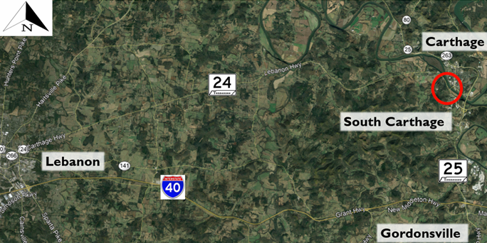
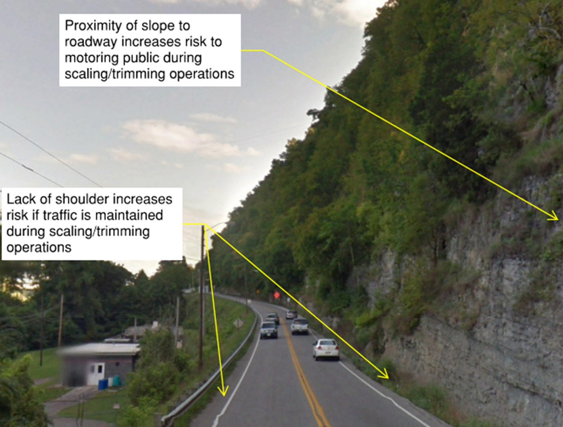
The project is located along State Route 24 (U.S. 70) in South Carthage (Smith County) from approximately Log Mile 9.9 to Log Mile 10.5. This section of roadway is a two-lane road with minimal shoulders (less than 3 feet), generally running north-south in the subject area. Although the catchment area ranges up to approximately 10 feet in width (far below current TDOT standards), debris in the ditch reduces the apparent effective catchment width to closer to 5 feet at many locations. Offset right of centerline, the slope length is approximately 3,050 feet with an estimated maximum height of 120 feet. Driver decision sight distance is considered “limited” to “very limited.” Per the TDOT Rockfall Hazard Rating System, this section is one of the most hazardous rock cuts in the state. Any rockfall debris released will affect the traffic flow, and subsequent damages to the State are considered likely. This site has been a reported rockfall problem for many years.
The stability of the rock slope is controlled by geologic structure and weathering. The primary failure mode of the rock slope is toppling or block release, with secondary failure modes of raveling and wedge failure, and a minor contribution from differential weathering. This project is currently in the Right-of-Way phase.

Purpose and Need of Project
The purpose of the project is to reduce the risks associated with the hazardous slope on the west side of SR-24 in South Carthage.
Recommendations
Mitigation of the rockfall hazard for this section of SR-24 should be accomplished utilizing a combination of manual scaling/trim blasting and installation of pinned mesh on the slope face. Installation of horizontal drains, as well as clearing of vegetation and debris from the bench and catchment area, are also recommended. This mitigation will only involve the original near vertical cut slope and will not extend to the true crest of slope in some areas. It is not the intent of this project to clear the entire slope. Disturbance above the anchor support zone shall be kept to a minimum to help avoid inadvertently accelerating the weathering process of any material present on the upper slope.
Due to the steep terrain of the project location, it is GES’s opinion this work should be performed by experienced rockfall mitigation experts familiar with limited access in rough topography. The slope should be accessed from the roadway, with work being completed using a crane platform to minimize clearing and site disturbance. Access for the construction of a conventional access road is available along the top of the slope utilizing construction easement, however, the access road would be a significant distance (vertically and horizontally) from the work location and would significantly increase the project scope as well as increase disturbance to the existing terrain above the rock slope. Therefore, it is inadvisable to access the slope using any measures beyond crane access from the existing roadway.
Construction Challenges
- Avoiding damage to existing infrastructure:
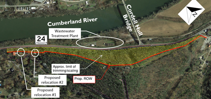
- Wastewater treatment plant located below SR-24 (east of highway);
- Historic Cordell Hull Bridge connects w/ SR-24 in project extents;
- Signal at SR-24/Cordell Hull Bridge intersection anchored to slope.
- Rockfall mitigation near Cordell Hull Bridge requires:
- Pre-blast survey of bridge;
- Installation of seismograph at bridge to record vibrations;
- Adjustment of blast charges according to seismograph readings;
- Blasting mats/rockfall drapery to prevent fly rock;
- Post-blast survey of bridge.
- Proposed R.O.W. requires relocation of two residences above slope.
- Proximity to Cumberland River requires coordination with TWRA to maintain boater safety during blasting operations.
- Creating a viable traffic control plan that maintains public safety of SR-24 during trimming/scaling operations.

Resources
Project Location Map (.kmz)