Mississippi Floodplain
Quick Facts
- Approximate Area: 99 square miles
- Also referred to as: Mississippi Alluvial Plain, Mississippi River Valley
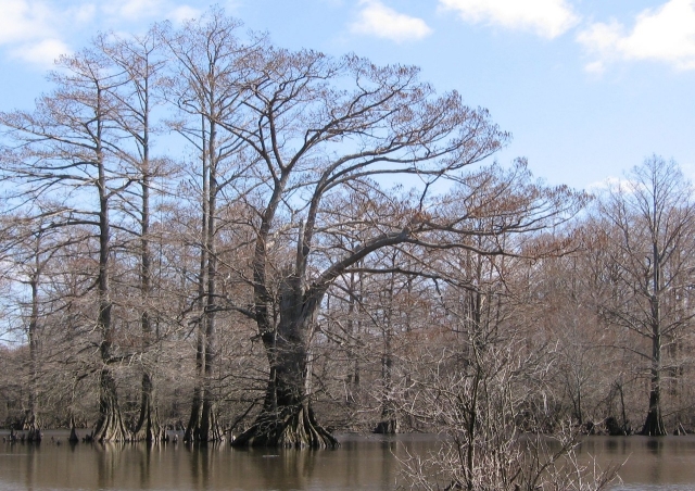
- Dominant plant community: southern floodplain forest (cypress, tupelo, and several oak species)
- Some rare plants and animals include: Pallid sturgeon (Scaphirhynchus albus, Federal Endangered), piebald madtom (Noturus gladiator, State Endangered), red starvine (Schisandera glabra, State Threatened), butternut (Juglans cinerea, State Threatened)
- Abbreviation in Rare Plant List: MF
Summary of Physiographic Province
Per the Guide to the Vascular Flora of Tennessee (Tennessee Flora Committee 2015) and the Ecoregions of Tennessee (USGS/EPA): The Mississippi Alluvial Plain is up to 14 miles wide and covers a total of 99 square miles. It extends north-south along the western border of the state (defined by the Mississippi River) and is bounded to the east by a series of bluffs. The Mississippi Alluvial Plain includes all of Lake County, western Obion County, about one-half of each of Dyer County and Lauderdale County, and a narrow strip of Tipton County and Shelby County. The entire area is within the former or present floodplain of the Mississippi River and contains shifting islands, bars, and channels that are strongly influenced by flooding. The landscape today includes extensive agricultural fields, bayous, swamps, river terraces, oxbow lakes, meander scars and natural and artificial dikes and levees. Reelfoot Lake in Lake and Obion counties, formed by a series of earthquakes in 1811 and 1812, is the largest natural lake in Tennessee and probably the best known natural landmark in this physiographic province. The natural vegetation consists of southern floodplain forest which includes tupelo (Nyssa sylvatica), bald cypress (Taxodium distichum), and several species of oak (Quercus sp.)