Application of Drones in the State

TDOT Use Cases:

Bridge Inspection

Drones supplement traditional bridge inspections by providing high-resolution aerial imagery and access to hard-to-reach areas, enhancing safety and efficiency while reducing the need for extensive lane closures and heavy equipment.

Disaster Response

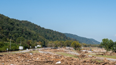
Drones assist emergency responders by providing real-time aerial views of disaster-affected areas, helping assess damage, locate survivors, and guide rescue efforts.

Surveying and Mapping

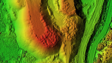
Drones improve efficiency in land surveys and infrastructure planning by capturing high-resolution aerial imagery and topographic data, enabling accurate mapping for transportation, utility, and development projects.

Construction Monitoring

Drones enhance construction site management by tracking progress, monitoring safety compliance, and providing detailed aerial documentation to improve project efficiency and decision-making.

TDOT recently received new drones to be used across multiple divisions. These drones are equipped with 3D modeling capabilities to aid in transportation applications. Check out the video here!

Drone Unboxing LinkedIn Video

Check out FHWA’s UAS Tech Briefs to learn more about drone applications:
https://www.fhwa.dot.gov/uas/library.cfm


Infographic highlighting four public benefits of drone technology with a drone in flight shown, including Safety, Efficiency & Accuracy, Emergency Response, and Service Delivery.