Roaring River
Tennessee Scenic River - Class I Natural River Area and Class II Pastoral River Area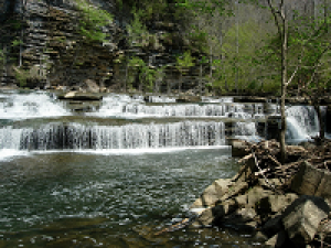
The Roaring River originates on the Highland Rim near Livingston, Tennessee and flows 37.7 miles to the confluence of Cordell Hull Lake. At the confluence is the U.S. Army Corps of Engineers Roaring River Recreation Area. It offers picnic areas, a campground and boat launch. Further upstream is the Boils Wildlife Management Area so named because at this point the rivers fast moving water runs into slower moving water that is pooled creating the appearance of boiling water. The Boils WMA is a popular paddling destination and wildlife viewing area. Kayakers can access the river here or further upstream at the TWRA put-in. Another scenic river attraction is Roaring River Falls located on Hwy 136.
Quick Facts
- Located in Overton and Jackson counties
- Approximately 20.5 miles designated
- Designated a Class I Natural River Area for 2 miles on April 4, 1968 as "That segment from State Route 136 downstream two (2) miles."
- Designated a Class II Pastoral River Area for approximately 18.5 miles on April 4, 1968 as "That segment downstream from a point two (2) miles downstream from State Route 136, to its confluence with the Cordell Hull Lake."